
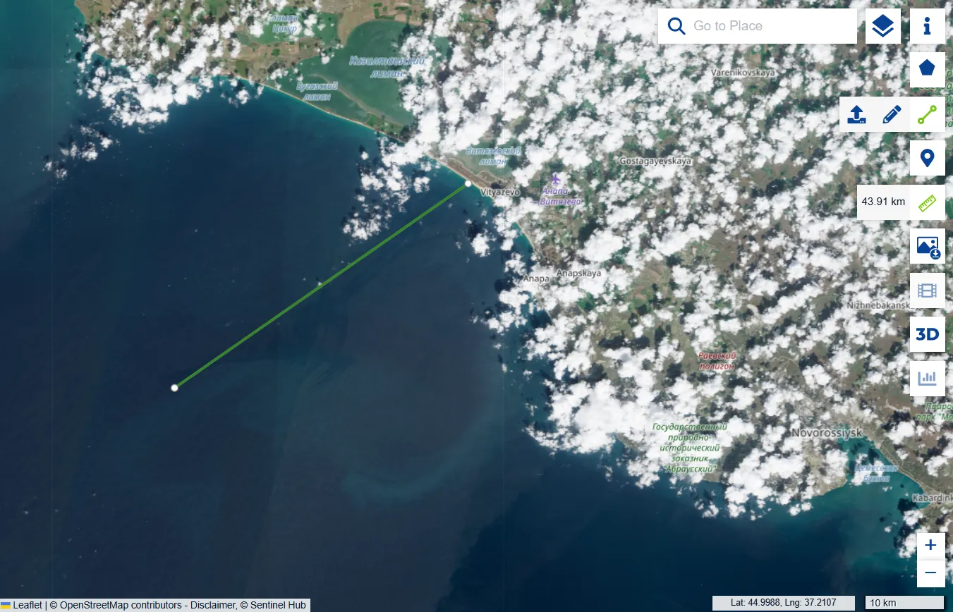
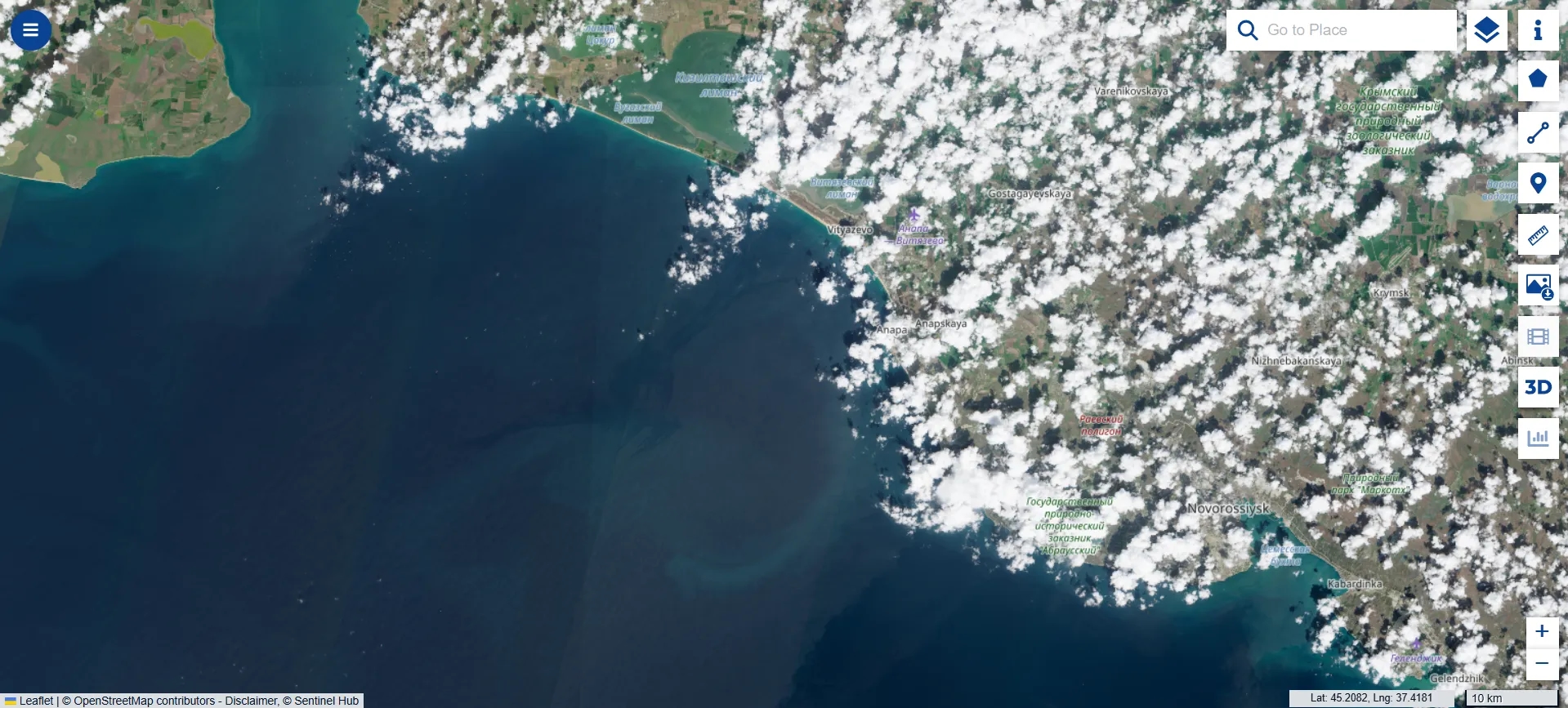
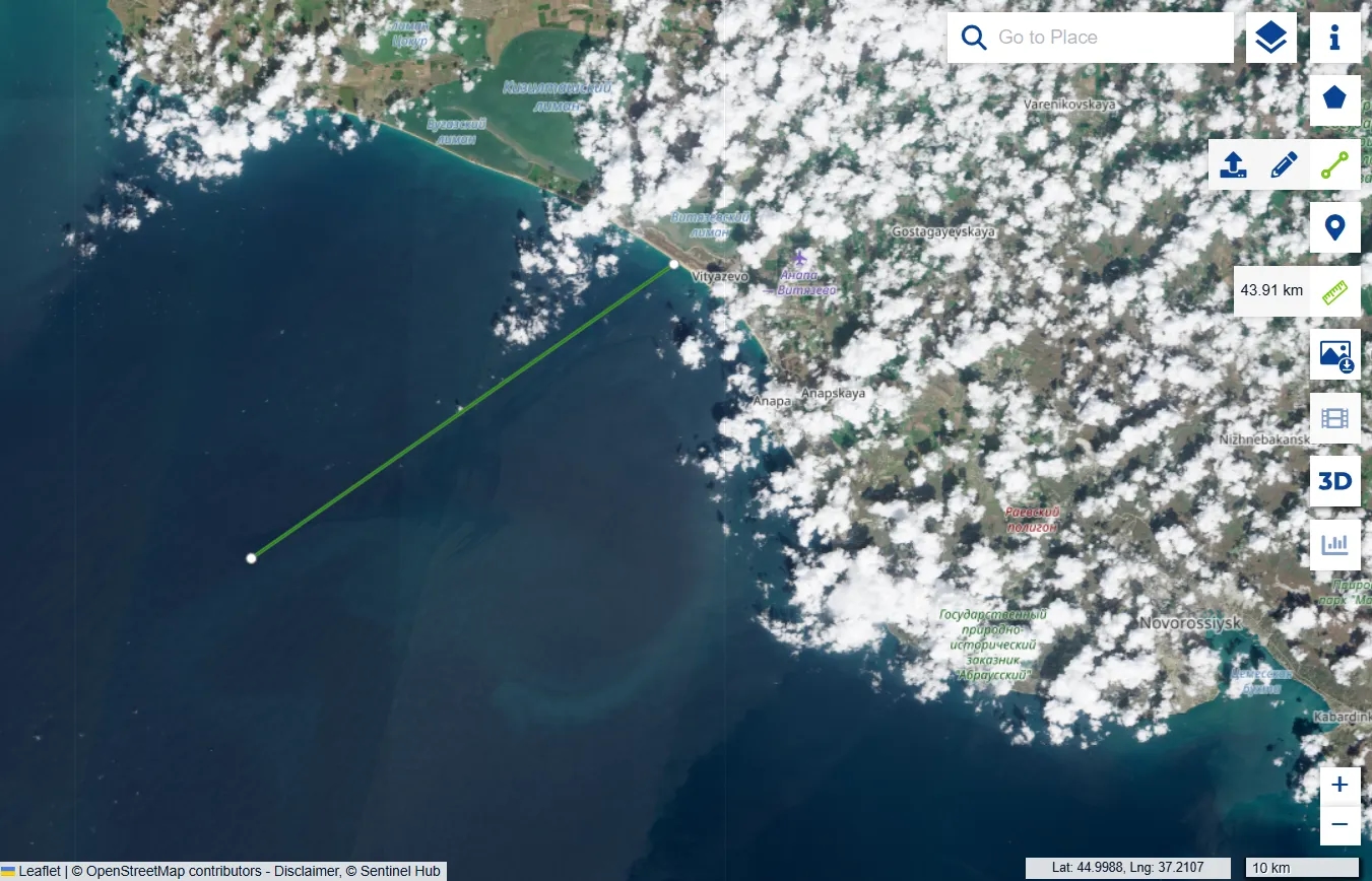
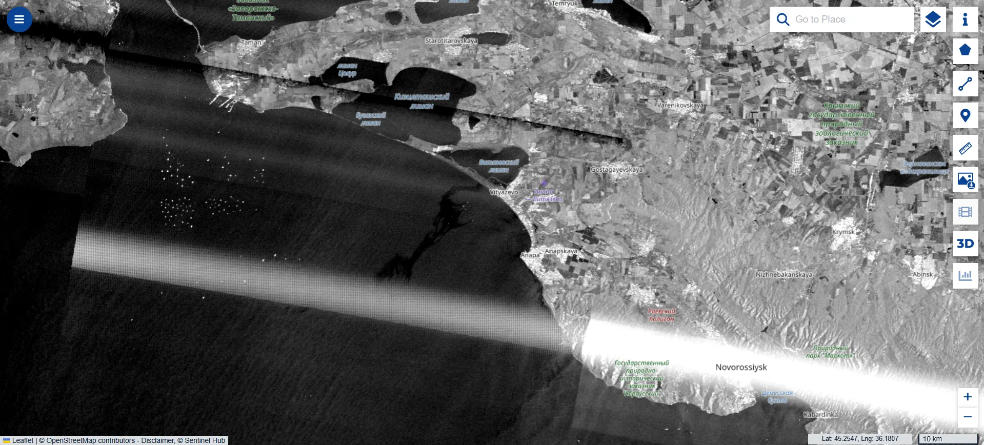
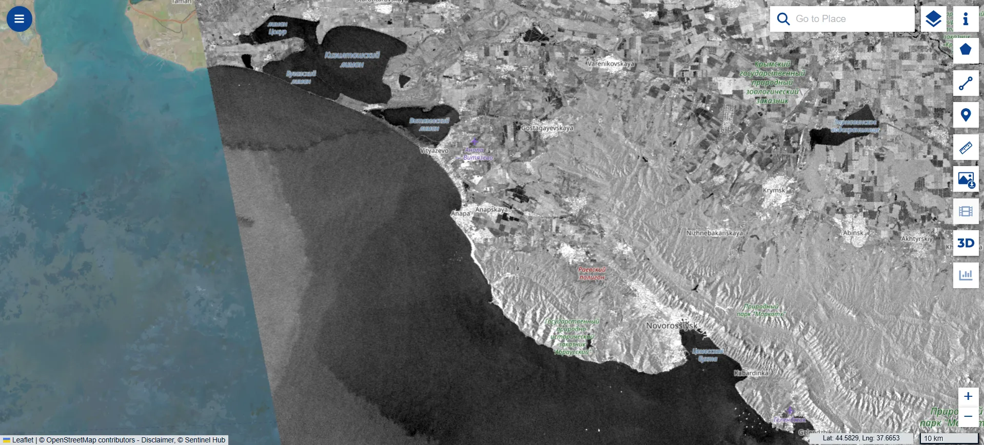
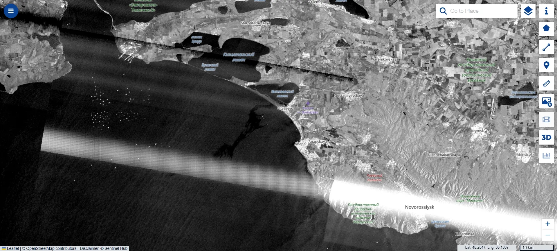
An oil slick has formed in the Black Sea off the coast of Anapa, visible in Sentinel satellite data reviewed by The Insider. The spill can be seen in satellite images taken on Sunday, April 12. The oil slick extends approximately 40 km from the Anapa coastline into the open sea. According to independent outlet Agentstvo, environmental experts estimate its area at around 110 square kilometers.

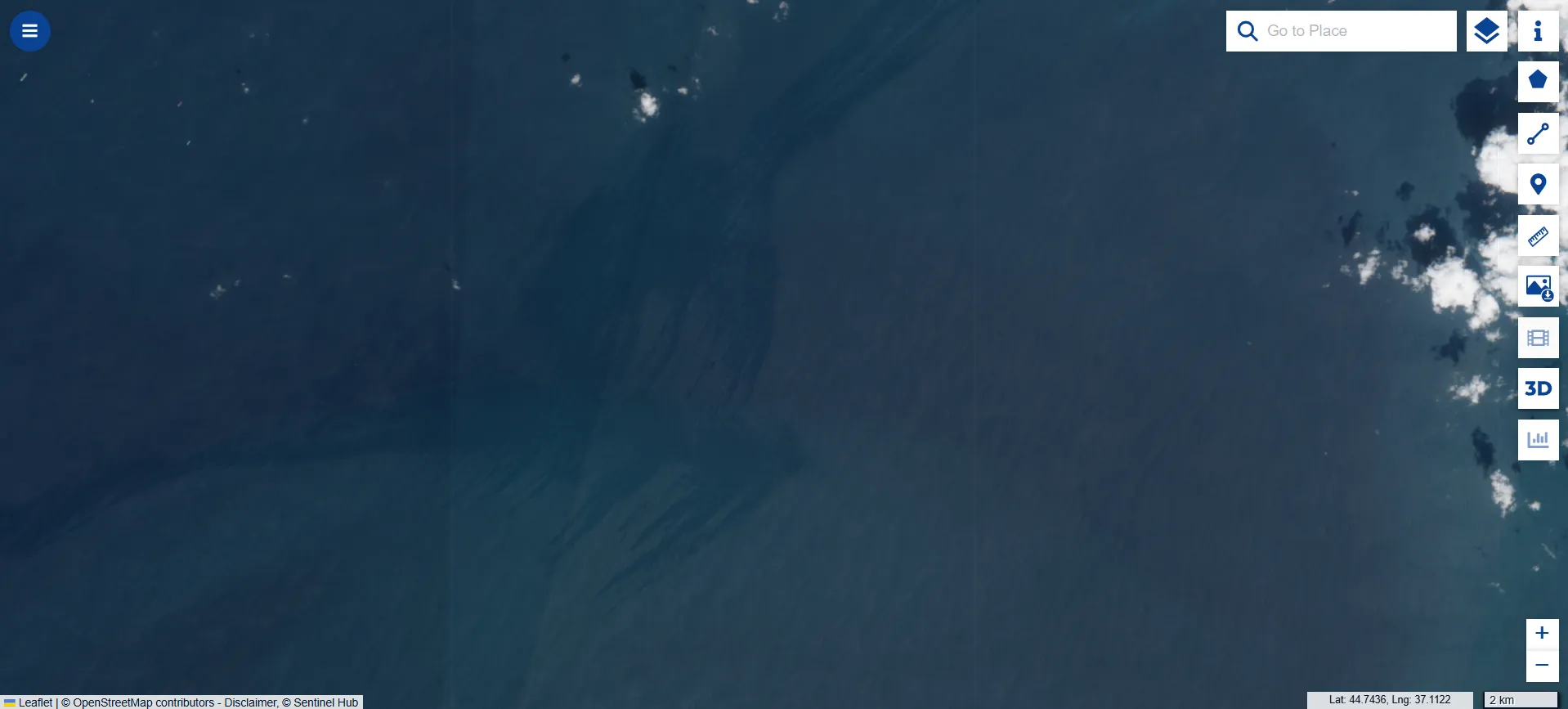
Due to heavy cloud cover, the available Sentinel-2 images for April 9 do not show this area on the map. However, in images taken by the Sentinel-1 satellite on April 8, the slick is not yet present. It remains unclear exactly when it formed.
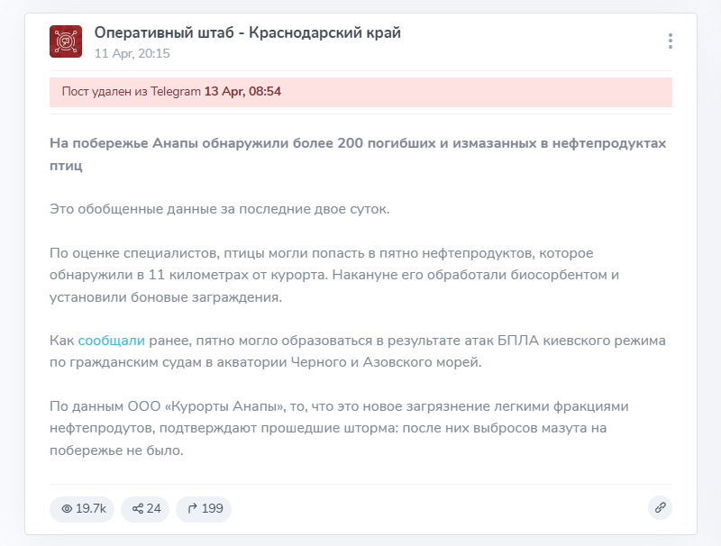
The Krasnodar Krai operations headquarters reported the discovery of the oil slick on April 11. At that time, it said that due to wind, the contamination was moving toward the Anapa–Vityazevo coastline. On the evening of April 11, regional authorities reported that more than 200 dead birds covered in oil products had been found on the shore over the previous two days. Although a Telegram post from the Krasnodar Krai’s “Operational Headquarters” Telegram channel disappeared on the morning of April 13, it remains available on the TgStat service.
The regional authorities attributed the cause of the spill to Ukrainian drone attacks on civilian vessels and oil infrastructure. It is unclear which specific attack may have led to these consequences. Krasnodar Krai is regularly subjected to drone strikes, and on April 5 a large-scale attack targeted Novorossiysk, which is located east of the site of the incident.
Earlier on Saturday, the region’s governor, Veniamin Kondratyev, reported at a meeting with Vladimir Putin that all beaches in the region would be opened to vacationers starting from June 1. They had been closed due to the aftereffects of the wreck of the tankers Volgoneft-212 and Volgoneft-239 in December 2024.